Physical Signature Characterization
Material Characterization
Cortana has more than 25 years of experience in the development of algorithms and data systems designed for use in the remote sensing of terrestrial and maritime targets. Our approach includes the development of Bidirectional Reflection Distribution Function (BRDF) models and algorithms used in conjunction with a database of more than 900 BRDF-characterized materials. This data system/database is supported by a material management program for the acquisition, tracking, prioritization, and characterization of materials of interest to the user. We also develop and distribute operational software to hundreds of users within the intelligence, defense, and commercial sectors, in the form of standalone releases (with GUI and API interfaces), web services, widgets, and applications.
Unlike traditional spectral libraries, our applications provide a system of data, parameters, and models to estimate effective reflectivities, emissivities, and radiances as a function of the user-specified geometry of the source, sensor, and target, as well as other in-scene parameters. Aperture radiance values, for example, are calculated based not only on geometry and material properties, but also properties of the background, atmosphere, sensor, and illumination source. Because our BRDF models extend between 0.3 and 15 µm, the system can be used to characterize optical properties for any sensor, unpolarized or polarized, within this spectral range. Once the directional response of a material is known, it may be exploited for applications such as material identification or classification, change detection, sensor selection and design, and collection geometry optimization.
Cortana continues to perform research and development in measurements, modeling, validation studies, materials science and applications. Through these efforts, we have evaluated and improved the accuracy of our traditional Modified Beard-Maxwell (MBM) BRDF model. We have also introduced a series of alternative models, based on both experiments and first principles theory, for select types of materials, such as soils, particulate contaminants, thin liquid layers, and large bodies of water (e.g., oceans, lakes, and littoral regions). Our team has been very successful in transitioning cutting edge R&D into operational algorithms, in order to meet user needs and mission priorities.
Geospatial Image Analysis
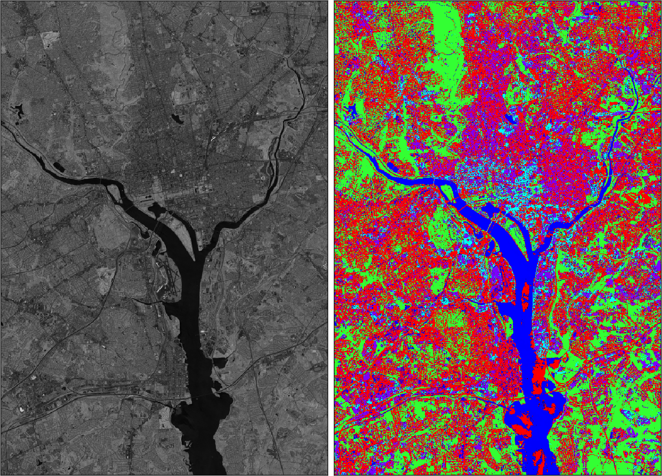
Example of ASTER imagery processed at Cortana
Cortana has ongoing programs examining overhead imagery from a variety of space- and aircraft-based platforms, acquired by passive and active sensing technologies. Cortana uses a variety of commercial, open-source, and custom software to get the most out of geospatial imagery. By combining these available tools with Cortana's extensive knowledge in material and atmospheric optical properties, ocean physics, and statistical discrimination methods, Cortana is able to identify and extract important information from geospatial imagery. A cornerstone of Cortana's approach to geospatial information extraction is ensuring that the technologies used can be customized to distill the unique, mission critical information, and ground that information in sound science.